Ασθενής χαμηλή πίεση επηρεάζει την περιοχή. Στην ατμόσφαιρα θα παρατηρείται κατά διαστήματα αραιή σκόνη.Σήμερα, ο καιρός θα είναι κυρίως συννεφιασμένος, ενώ αναμένονται τοπικές βροχές οι οποίες το απόγευμα πιθανό να συνοδεύονται από βροντές.
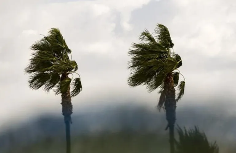
Οι άνεμοι θα πνέουν κυρίως βορειοανατολικοί ως νοτιοανατολικοί, μέτριοι μέχρι ισχυροί, 4 με 5 μποφόρ, αλλά στα προσήνεμα ισχυροί μέχρι πολύ ισχυροί, 5 με 6 μποφόρ και παροδικά μέχρι σφοδροί, 6 με 7 μποφόρ. Η θάλασσα θα είναι μέχρι κυματώδης. Η θερμοκρασία θα ανέλθει στους 12 βαθμούς στο εσωτερικό, γύρω στους 15 στα παράλια και στους 4 βαθμούς στα ψηλότερα ορεινά, όπου τοπικά θα παρατηρείται παγετός.
Απόψε, ο καιρός θα συνεχίσει να είναι κυρίως συννεφιασμένος με τοπικές βροχές οι οποίες πιθανό να συνοδεύονται από βροντές. Στις ψηλότερες κορυφές του Τροόδους αναμένεται να πέσει χιόνι ή χιονόνερο. Οι άνεμοι θα πνέουν αρχικά βορειοανατολικοί ως νοτιοανατολικοί και αργότερα βόρειοι ως βορειοανατολικοί, μέτριοι, 4 μποφόρ και τοπικά μέχρι πολύ ισχυροί, 5 μποφόρ.
Η θάλασσα θα είναι μέχρι κυματώδης. Η θερμοκρασία θα πέσει στους 8 βαθμούς στο εσωτερικό, γύρω στους 11 στα παράλια και στους 4 βαθμούς στα ψηλότερα ορεινά, όπου τοπικά θα παρατηρείται παγετός.
Την Παρασκευή, ο καιρός θα είναι μερικώς συννεφιασμένος και αναμένονται κατά διαστήματα μεμονωμένες βροχές χωρίς να αποκλείεται και χιόνι ή χιονόνερο στις ψηλότερες κορυφές του Τροόδους.
Το Σάββατο, αναμένονται τοπικές βροχές και μεμονωμένες καταιγίδες, καθώς και χιόνια στα ψηλότερα ορεινά. Το απόγευμα ο καιρός αναμένεται να βελτιωθεί αισθητά. Την Κυριακή, ο καιρός θα είναι μερικώς συννεφιασμένος.Η θερμοκρασία μέχρι την Κυριακή θα σημειώσει σταδιακά άνοδο, κυρίως στο εσωτερικό, για να κυμανθεί κοντά ή λίγο πιο πάνω από τις μέσες κλιματολογικές τιμές.Το ύψος του χιονιού στη Χιονίστρα, κατά την ώρα έκδοσης του δελτίου, ήταν 20 εκατοστά.
Rain, Storms and Strong Winds - Winter Scenery Until Saturday
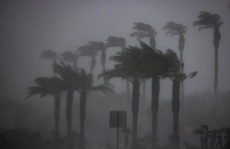
A weak low-pressure system is affecting the area, causing intermittent sparse dust in the atmosphere. The weather is expected to be mainly cloudy with local showers, which may be accompanied by thunderstorms in the afternoon. Winds will be blowing from the northeast to southeast, moderate to strong, but strong to very strong in exposed areas, with temporary increases. The sea will be up to wavy. Temperatures will range around 12 degrees Celsius inland, around 15 degrees Celsius on the coast, and 4 degrees Celsius in the higher mountains, where local frost is expected. Tonight, the weather will remain cloudy with local showers and possible thunderstorms, while snow or sleet is expected in the higher mountains of Troodos. Friday will see partly cloudy weather with scattered showers, as well as the possibility of snow or sleet on the highest peaks of Troodos. Saturday will bring local showers and isolated thunderstorms, with snow in the mountains. The weather is expected to improve significantly in the afternoon. The temperature will gradually rise until Sunday, mainly inland, and will be around or slightly above the average climatic values. The snow height at Chionistra, at the time of the bulletin, was 20 centimeters.
You Might Also Like

Βροχές, καταιγίδες και σκόνη στην ατμόσφαιρα
Jan 21
Προειδοποίηση για σφοδρούς ανέμους μέχρι 7 μποφόρ
Jan 21

«Χαλάει» ο καιρός Αναμένονται βροντές και σφοδροί άνεμοι

Στο «μενού» βροχές, χιόνια μέχρι και σφοδροί άνεμοι αλλά και σκόνη
Jan 22

Βροχές και ισχυροί άνεμοι στο σκηνικό του καιρού - Χιόνια στο Τρόοδος
Jan 22